


Metar-Taf is a comprehensive weather application designed specifically for aviation enthusiasts and professionals. This app provides visualized METAR and TAF weather information for airports worldwide, offering users an easy-to-understand, colorful interface with concise summaries of essential aviation weather data. Key features include crosswind calculations, flight rule categorization (VFR, MVFR, IFR, LIFR), and text-to-speech functionality for decoded METAR reports.
In addition to its robust METAR capabilities, Metar-Taf offers detailed TAF breakdowns displayed hourly in tables, complete with sunrise/sunset times and temperature extremes. Users can track their favorite stations, access local observations, and search airports by ICAO code or name. The app also includes historical weather trend graphs, airport information, customizable units, and automatic data saving for offline use. Available in six languages, Metar-Taf is an indispensable tool for pilots and aviation planners.
Metar-Taf stands out with its extensive feature set tailored for aviation weather analysis. The app's METAR visualization presents complex weather data through intuitive metrics and symbols, making it accessible even to non-aviation professionals. Its unique crosswind calculation combines METAR and runway information, providing crucial data for flight planning.
The TAF section breaks down terminal aerodrome forecasts into hourly tables, enhancing usability. The app's tracking capabilities allow users to maintain a list of favorite stations, access location-based observations, and utilize an interactive map with weather codes. With advanced calculations including customizable units and automatic time conversions, plus comprehensive airport details, Metar-Taf delivers a sophisticated yet user-friendly experience for aviation weather monitoring.
Accurate weather forecasting is essential for aviation safety and planning. Metar-Taf provides highly reliable METAR and TAF data for airports worldwide, ensuring pilots and aviation professionals have the most up-to-date information.
The app visualizes weather data through easy-to-understand colorful metrics and symbols, similar to non-aviation weather reports. This includes detailed breakdowns of significant weather conditions, cloud formations, and visibility, all crucial for flight preparation.
By integrating real-time METAR updates with predictive TAF forecasts, the app offers comprehensive insights into current and future weather patterns. Users can access detailed hourly tables showing sunrise, sunset, and temperature fluctuations, enhancing their ability to anticipate changing conditions.
Furthermore, the app's data accuracy is reinforced by its offline functionality, allowing users to access saved METAR, TAF, and airport information without an internet connection. This ensures that even in remote locations, pilots can rely on credible and timely weather data.
Understanding both the temporal and spatial dimensions of weather forecasts is vital for effective aviation planning. Metar-Taf excels in providing extensive forecast ranges that cover various timeframes and geographic areas, catering to diverse operational needs.
The app breaks down TAF forecasts into hourly tables, offering a granular view of weather conditions over time. This allows users to see precise changes in weather patterns, such as minimum and maximum temperatures, which are critical for long-duration flights.
Metar-Taf also supports spatial analysis by enabling users to find stations on an interactive map using weather codes. This feature helps pilots locate nearby weather stations and understand regional weather dynamics, improving situational awareness.
Additionally, the app calculates sunrise and sunset based on each airport's latitude and longitude, converting times to local time zones. This global coverage ensures that users receive accurate temporal data regardless of their location, enhancing overall flight safety and efficiency.
User-friendly interface
Comprehensive weather data
Offline functionality
Multilingual support
Customizable units
Premium features may require payment
Occasional data delays
Complex for beginners
Limited free features
Heavy on system resources

Live local weather updates: various widgets & radar maps & hourly forecast.
 4.70
4.70
Weather related custom complications for Wear OS. UV, Hi-Lo, AQI and more!
4.40
Hourly and daily weather forecast, current condition, temperature, UV and more!
4.70
Room Temperature Thermometer meter shows indoor, outdoor temperature, humidity.
4.40
Arrive safely! Travel weather forecasts for your entire trip at time of arrival.
3.60
My Tide Times Pro is the only tide tables and forecasts application you'll need.
4.80
Weather watch face for Wear OS 5
4.40
Precision Weather, Right at Your Fingertips
4.40
All-in-one weather radar launcher with rain, temperature maps & local forecast.
4.30
Local weather forecast app, your personal 7*24 local weather forecast assistant.
4.90
A professional, comprehensive and accurate weather forecast app
4.90
Powerful US and worldwide earthquake feed with earthquake alerts and maps.
4.60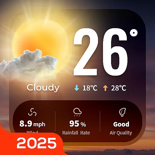
Your Trusted Weather Companion
4.40
Accurate Local Weather Forecast, let you easily understand the nearby weather!
4.20
Live NOAA weather app to track storm, rain, wind, lightning & real local updates
4.20
3D Animation Weather Icon
4.00
Most precise & accurate compass app give true North South East West directions.
3.00
Retro TV-style digital watch face with weather, heart rate, steps & events!
4.1
Dynamic weather watch face with glass effect, bold time & 7 complications.
4.3
User Reviews